The Indian Space Research Organization (ISRO) will include the L1 frequency in all of its future satellites to promote the use of “NAVigation with the Indian Constellation” (NavIC), the Indian version of GPS, Union Minister of State for the Department of Space Jitendra Singh recently stated in Parliament.

According to Singh, the following satellites, starting with NVS-01 and onward, will have an L1 band for civilian navigational use.
Two frequencies, the L5 and S bands, are used by the seven satellites in the NavIC constellation so far to provide positional information. These satellites’ replacements, the future NVS-01 satellites and thereafter, will also carry L1 frequency. Even less complex, consumer-grade gadgets like smartwatches may pick up the L1 signal, which is the oldest and most reliable GPS signal. The use of NavIC in devices for civilian use can therefore increase with this band.
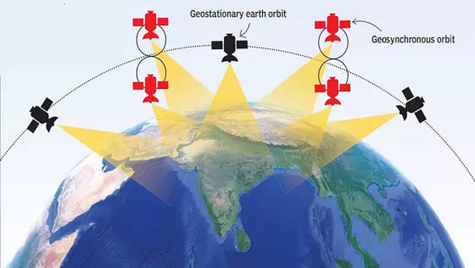
NavIC is India’s in-house version of GPS. The navigation satellite system, created by ISRO, was first approved in 2006 at a cost of $174 million, but it wasn’t until 2018 that it started to function. It currently has eight satellites and covers all of India as well as areas up to 1,500 km from its borders.
NavIC is as precise as GPS, according to the authorities. Singh reaffirmed that the “performance of NavIC system is on par with the other positioning systems” in his response to Parliament.
NavIC is mostly used for tracking data linked to natural disasters, emergency warning messages for fishermen heading into deep sea, and public vehicle tracking.
In a nutshell, the government claims that India shouldn’t rely on positioning systems operated by foreign governments since they face the risk of being suspended for civilians during emergencies. Additionally, NavIC will be more accurate than other systems because it was developed in-house.
The system is projected to become more accurate than GPS once the constellation is completely operational and there are ground stations outside of India. ISRO aims to install ground stations in Japan and France to better triangulate the entire area covered by NavIC. In comparison to GPS, which India gets at an angle and is challenging to use in deep forest or valleys, the satellites placed directly over India ensure improved signal availability in a variety of geographical regions.
Source: Indian Express

